Trail Bicycle tourism District of Bratislava I - Descente Danube - Bratislava - Litop - Photo

Descente Danube - Bratislava - Litop

 s0c7
s0c7

User

© OpenStreetMap contributors
Length
Length
69 km
Max alt
Max alt
152 m
Uphill gradient
Uphill gradient
317 m
Km-Effort
Km-Effort  
74 km
Min alt
Min alt
112 m
Downhill gradient
Downhill gradient
350 m
Boucle
Boucle
No
Creation date :
2024-07-26 06:51:16.424
Updated on :
2024-07-26 17:46:37.002

(0 Reviews)

Bicycle tourism
Bicycle tourism
4h32
Difficulty : Medium

Scan this QR Code to open this trail in the SityTrail application

FREE GPS app for hiking

Logo SityTrail SityTrail

IGN / Geographical institutes

Download SityTrail from the App Store Download SityTrail from Google Play

Logo SityTrail SityTrail World

The world is yours!

Download SityTrail from the App Store Download SityTrail from Google Play Download SityTrail on Huawei AppGallery

About

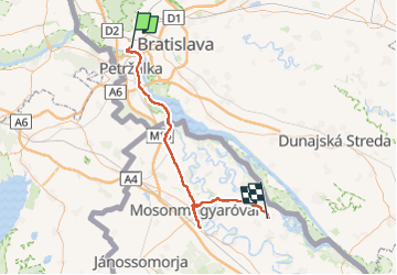
Trail Bicycle tourism of 69 km to be discovered at Region of Bratislava, Bratislava, District of Bratislava I. This trail is proposed by s0c7.

Elevation profile

Positioning

Country:
Slovakia
Region :
Region of Bratislava
Department/Province :
Bratislava
Municipality :
District of Bratislava I
Location:
Bratislava - mestská časť Staré Mesto
Start:(UTM)
657342 ; 5334699 (33U) N.

Trails nearby

Trail Walking District of Bratislava I - Bratislava  - Photo
Walking
chrochas

Walking

Difficult
District of Bratislava I, Region of Bratislava, Bratislava, Slovakia
12.9 km | 15.7 km-effort
2h 50min
Yes


Close
My subscriptions